
***SEVERE STORMS AND FLASH FLOODING BOTH POSSIBLE TODAY INTO TONIGHT***
Quite a bit has changed in a relatively short period regarding the *timing* of our severe weather potential today. Heads up so no one is caught off guard!
Forecast models had previously been fairly consistent with brining a line of showers and potentially strong-to-severe thunderstorms into the Upper Cumberland later this evening, after sunset.
Well… that idea has changed.
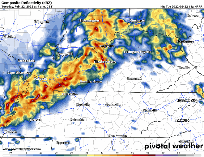
Based on radar trends this morning now that we can actually *see* the rain and storms back to our west, and in coordination with latest model trends, it now looks like this line will *not* stall out across southern/central Kentucky today as previously thought as will instead move right on into our area this afternoon.
What does this mean for us here in the Upper Cumberland?
Our severe storm potential will arrive earlier than thought. The best chance ETAs for strong to severe storms are as follows:
Those in our northwest zones from Carthage, up to Lafayette, Celina and Hartsville could see storms as early as noon to 3 p.m. CST.
This line will move perpendicularly through the Upper Cumberland from northwest to southeast throughout the afternoon hours, reaching Cookeville and points SW and NE (Smithville/Livingston) around 1:30 to 4:30 p.m. CST.
Our far southern and eastern areas (Crossville/Jamestown/Sparta) will see the storms arrive around 3 to 6 p.m. CST.
I’ve left these ETA windows somewhat open-ended to account for any variations in radar or model trends as we move through the next few hours, as things can still change.
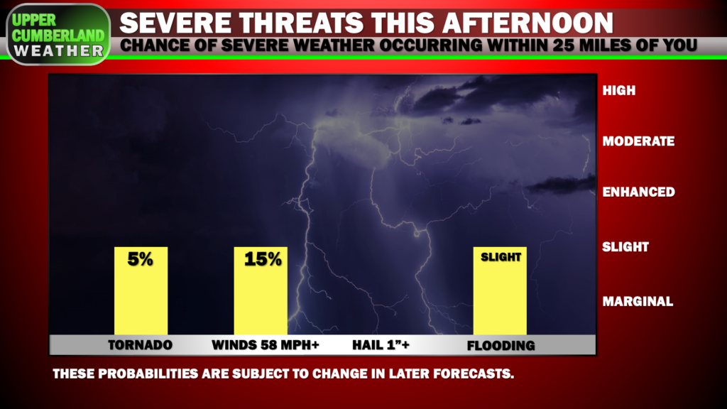
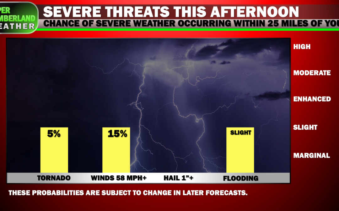
As far as what to expect, this continues to look like more of a straight-line damaging wind threat with a 15% probability of winds in excess of 58 mph occurring within 25 miles of any given location.
An isolated tornado or two also can’t be ruled out, but that probability drops to 5% in a 25 mile radius.
The severe threat in general looks to decrease just a tad the farther east you are in the Upper Cumberland, particularly on the Plateau. That said, all areas are included in some form of risk this afternoon.
Once an area approaches the end of their severe weather potential window (no severe storms are expected late this evening through the overnight hours), the primary threat will shift to flash flooding, as persistent moderate shower activity will linger with us for much of the evening and overnight hours.
A Flood Watch will go into effect at noon for the threat of quick water rises in low-lying and flood-prone areas.
This will be quite an active day in the weather department, so be sure to stay tuned for later updates from multiple reliable weather sources.
We’ll have further updates posted throughout the day and will provide LIVE severe weather coverage across our social media platforms if and when needed.