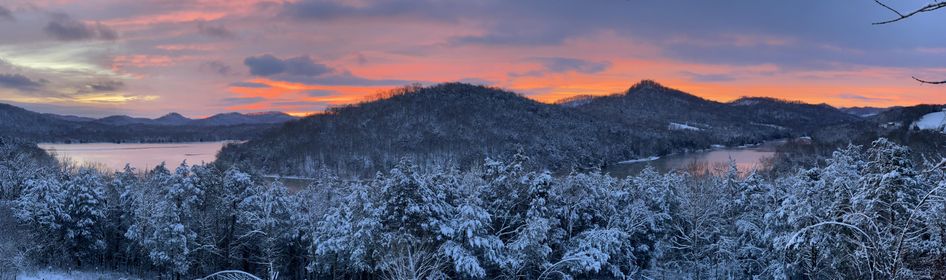
Today’s featured image was sent to us from Connie La Barge Golden. This beautiful sunrise shot was captured Friday morning in Elmwood.
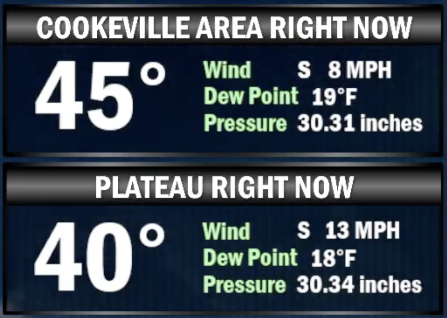
The great melting has commenced, as temperatures area-wide has risen into the 40s the afternoon. Here were the temps measured at the Sparta and Crossville airports as of the noon hour today:
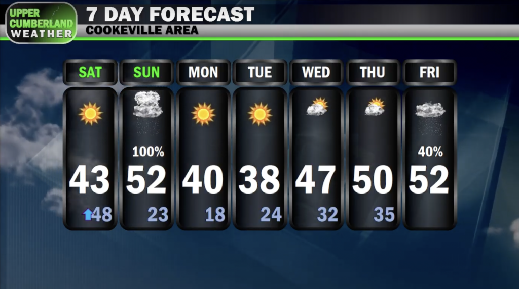
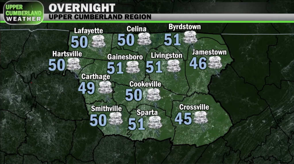
We’ll actually climb *higher* through the overnight period into the upper 40s to near 50 before our next storm system arrives during the early morning hours Sunday.
A warm frontal boundary will begin to lift north and east into Middle Tennessee late tonight, bringing with it some gusty winds out of the south and a significant plume of moisture.
On the heels of this boundary will be a cold front — the combination of which will bring an extended period of moderate to heavy rain showers and a few embedded thunderstorms beginning early morning Sunday and lingering throughout much of the afternoon before tapering off.
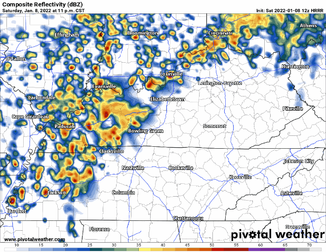
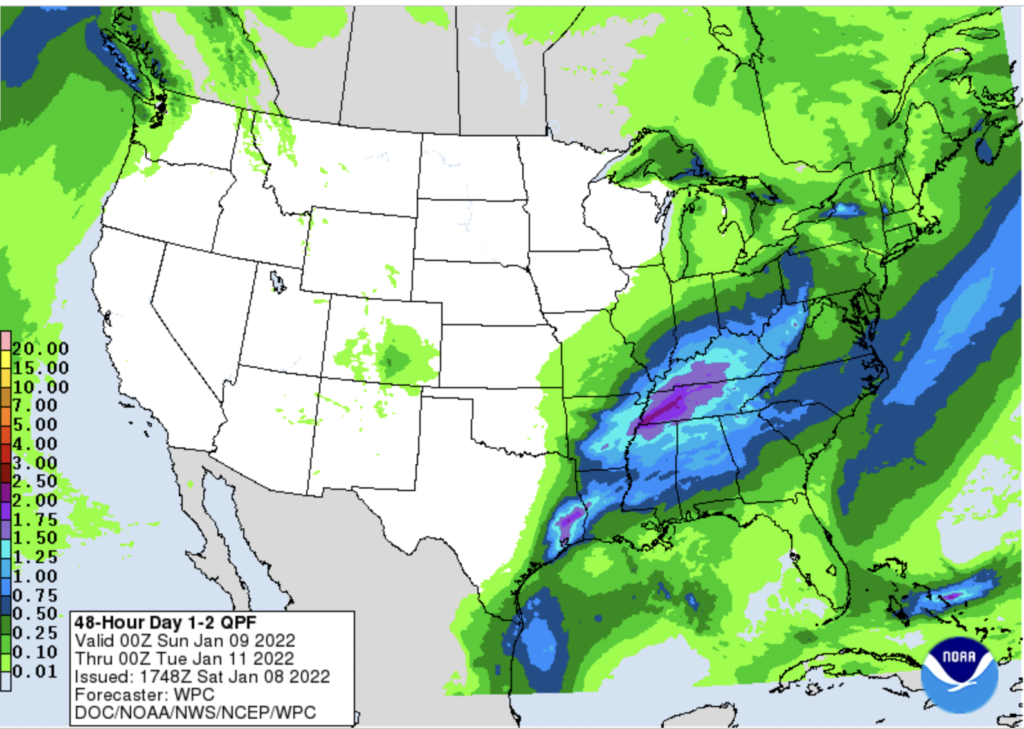
As much as two inches of rain with locally higher amounts appears likely tomorrow.
The combination of snow melt (the water equivalent of over a half inch of rain in many areas, especially north and west) and the heavy rain we’re expecting tomorrow may lead to localized flooding issues developing in a few spots.
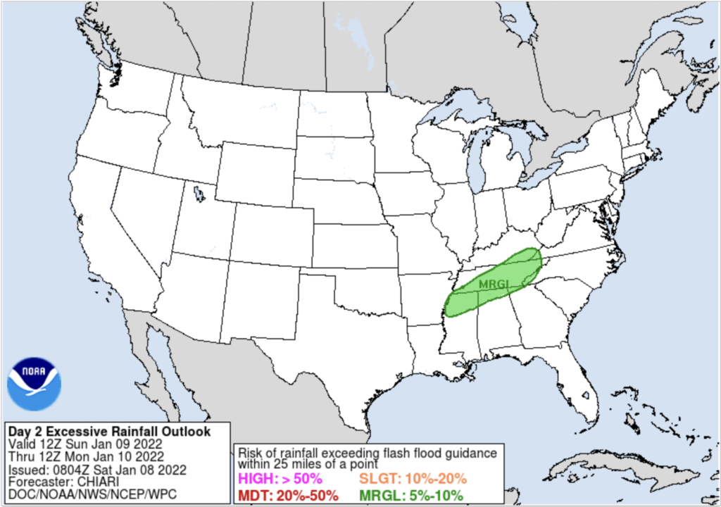
The Weather Prediction Center has issued a Marginal Risk of flash flooding in their excessive rainfall outlook for tomorrow.
Should any flooding occur, it would most likely be in poor drainage spots along some roads and near creeks and streams that are prone to flooding.
The flood threat is one we will be monitoring throughout the day tomorrow. NWS Nashville has mentioned the possibility of a Flood Watch being issued for part of our region, but we’ll have to wait and see on that.
As far as severe weather goes, instability with this system looks to be quite limited. We may hear a few rumbles of thunder at times, but we’re not expecting any issues with damaging straight-line winds or tornadoes. We’ll let you know if anything changes on that front.
As this system begins to move out of here Sunday evening, it’s possible we could see a brief wintry mix with temperatures falling back below freezing. No impacts are expected, however. Any precipitation should be long gone by late evening/overnight.
The first half of next week is looking dry but chilly with temperatures running a bit below average in the upper 30s to lower 40s. Milder temperatures and rain chances will return toward the end of the week.