
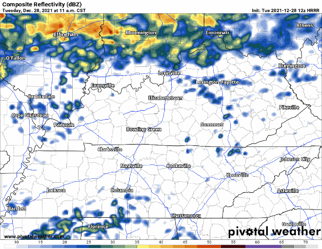
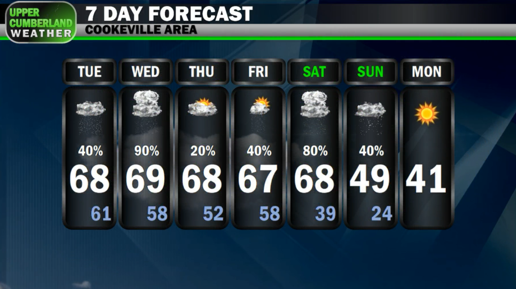
Much like yesterday, our Tuesday will be off and on wet with light showers scattered around during the afternoon and evening hours.
We’re not expecting any thunderstorm development today, and most showers should be on the lighter side or just sprinkles.
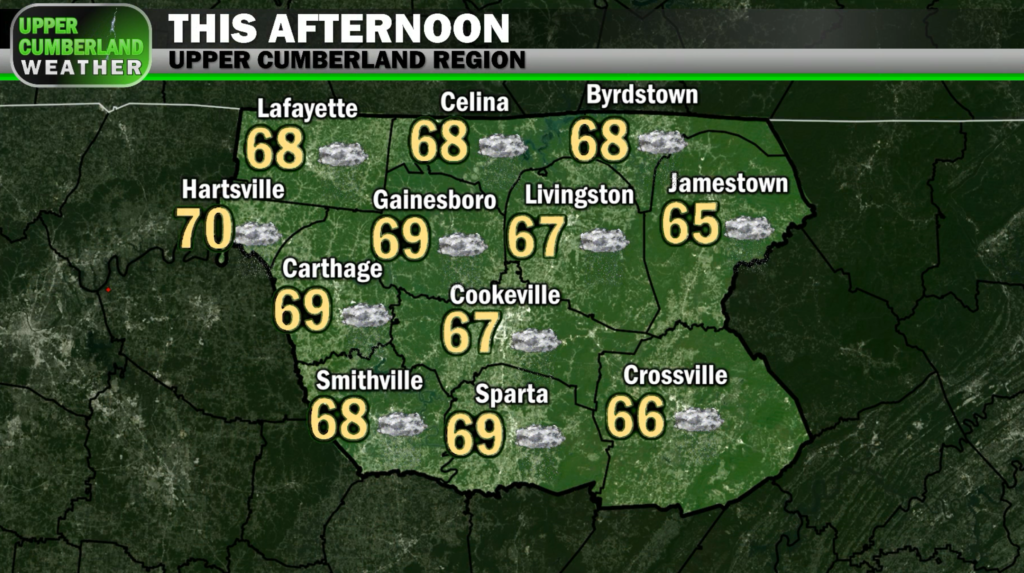
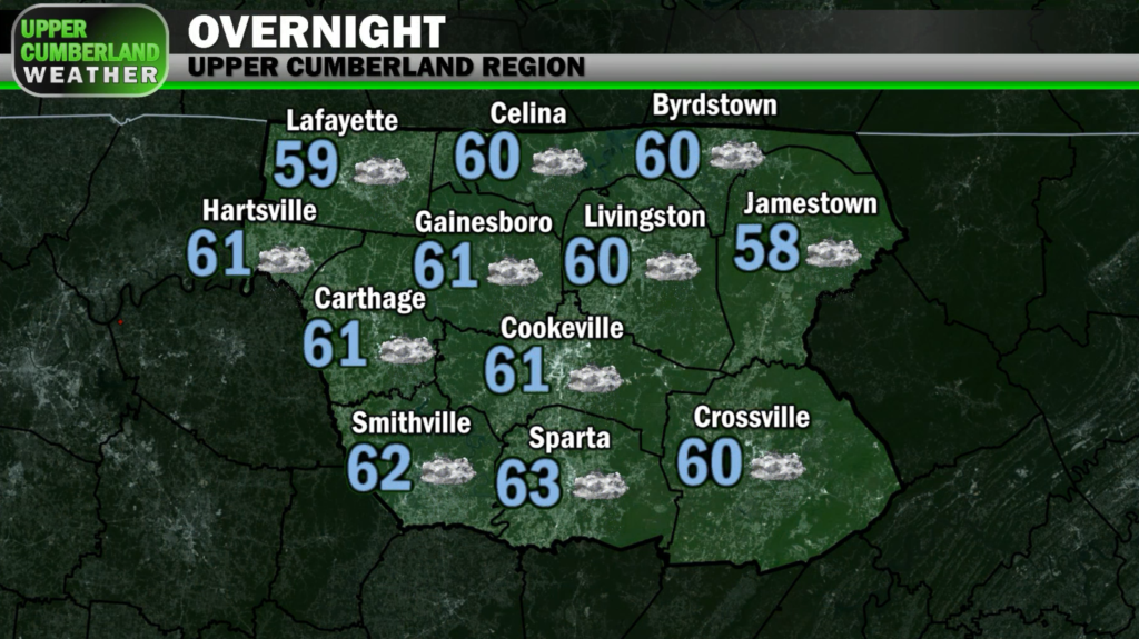
Highs this afternoon will again remain mild in the upper 60s (mid 60s Plateau). Lows will only fall down into the lower 60s overnight.
A few thunderstorms may try to develop during the early to mid morning hours as instability begins to increase ahead of the cold front that will be driving our storm chances later in day Wednesday and into the nighttime hours.
It’s possible we could see a few passing showers or isolated thunderstorms around during the day Wednesday, but we’re otherwise looking dry for the most part with highs comparable to today in the upper 60s to around 70.
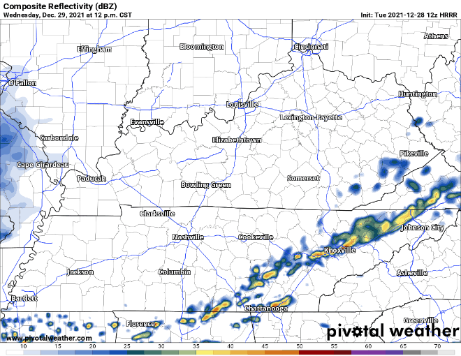
Scattered showers and thunderstorms look to develop across our region during the early to mid evening hours Wednesday with thunderstorms continuing overnight, perhaps lingering into the early to mid morning period Thursday.
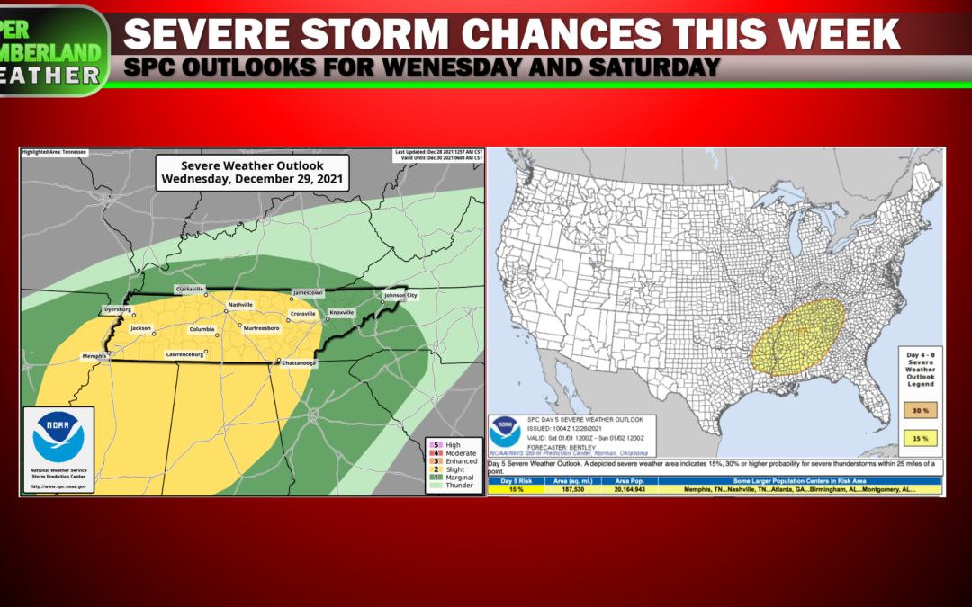
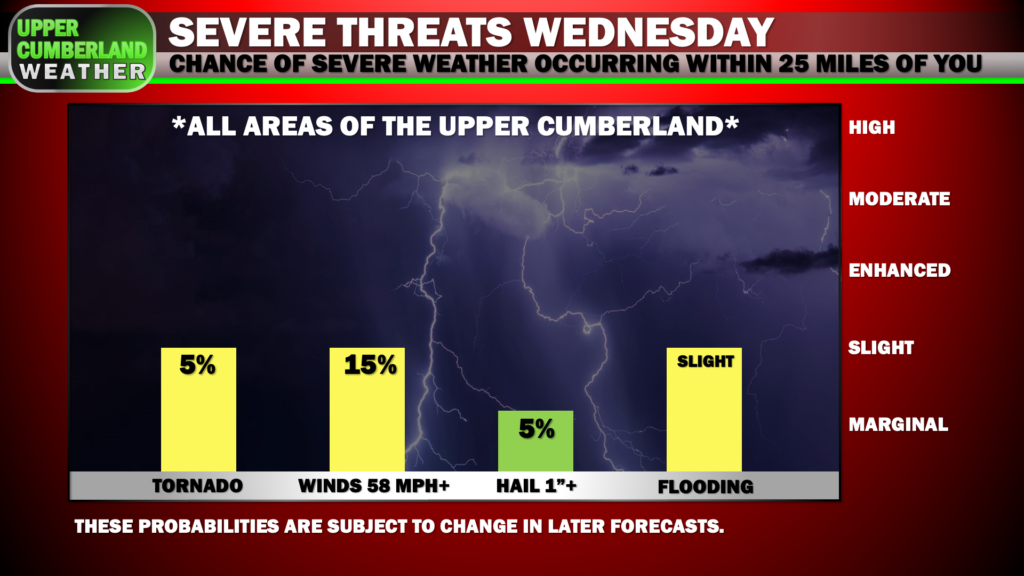
The Storm Prediction Center has increased our severe weather outlook to the ‘Slight Risk’ category for Wednesday, introducing a 15% probability of damaging winds and a 5% probability of an isolated tornado or two occurring within 25 miles of any given location.
Instability with this system looks to be greatest across parts of Mississippi, Alabama and southern Tennessee, but the track of a surface low to our north driving this system will play a big role in how far north that more unstable airmass reaches.
Should the low track farther north, we’ll be in a more supportive environment for tornado development. If the low tracks farther south, this will primarily be a low-end damaging wind event for us — if that.
Based on recent short-range model guidance, it appears the better chance for tornado development (though still relatively low) will be along and south of I-40, so from Cookeville, south to Sparta, Smithville, Crossville, etc., although no area is out of the woods for this threat.
Again, the greater threat will be straight-line damaging wind gusts with any storms we see during the evening and overnight hours Wednesday. Isolated large hail also can’t be ruled out.
We’ll also have to keep an eye on how much rainfall we receive, as it’s possible a few localized flooding issues could develop.
We’re expecting anywhere from 1-2 inches of rainfall with this event. Locally higher amounts can’t be ruled out.
Once we get past this event, Thursday and Friday are both looking relatively quiet with a few passing showers possible, especially Friday. Temperatures will remain mild in the 60s.
Our attention will then turn to New Year’s Day as an even more pronounced storm system works its way across the region.
Forecast models still aren’t in total agreement with how this system will evolve, but all modes of severe weather continue to appear possible Saturday, including the possibility of a tornado or two.
SPC is continuing the 15% severe weather probability for all of Middle Tennessee Saturday in their Day 5 convective outlook.
As far as timing goes, those details are still to be ironed out over the coming days, so stay tuned for further updates.
The backside of Saturday’s storm system will usher in much colder air for Sunday. At this time, it does appear a few wet snowflakes are possible, but any accumulation should be light and likely confined to just the Plateau. That said, this forecast will change many times between now and this weekend, so stay tuned.
With two severe weather threats upon us this week — the first coming tomorrow — now is the time to review your severe weather safety plan.
Make sure your NOAA weather radio has fresh batteries and is programmed to receive alerts for your location. Your phone should be fully charged tomorrow with your weather alerts app set to notify you of any warnings.
Make sure your tornado safe spot is cleaned out and prepped in case you need to seek shelter. If you live in a mobile home or other non-sturdy shelter, make arrangements now for where you can ride these storms out safely.
Hopefully we’ll get through both events without much fuss, but this serves as a stern reminder that we’re very much in the thick of our severe weather season. Severe storms do not discriminate against what time of year it is in Tennessee, so always be prepared.
This is aww appreciate every thing you