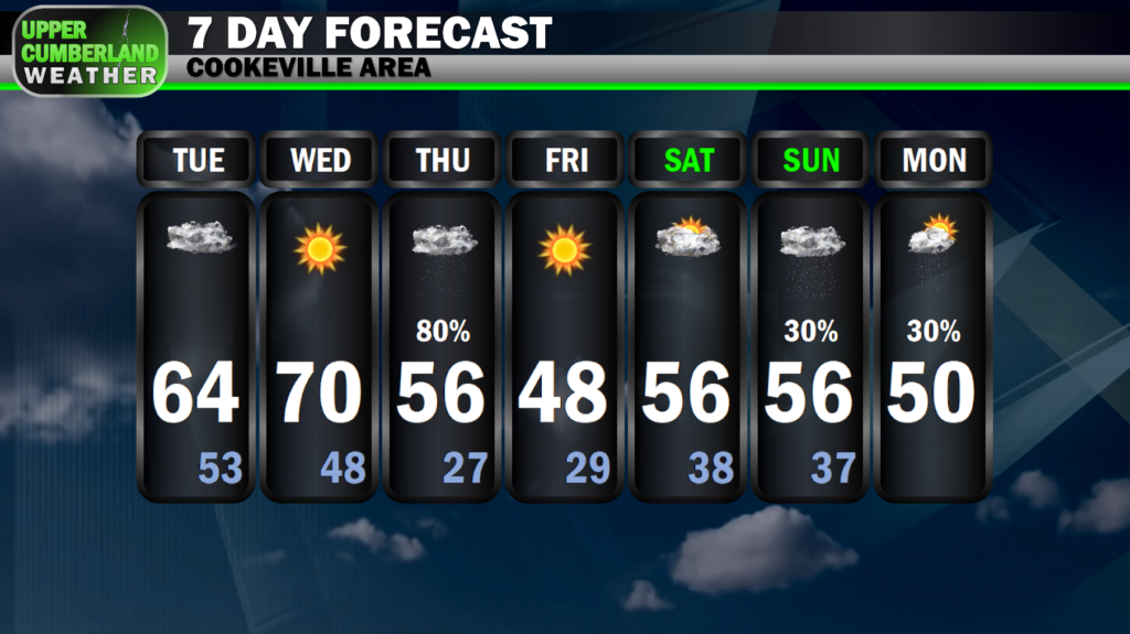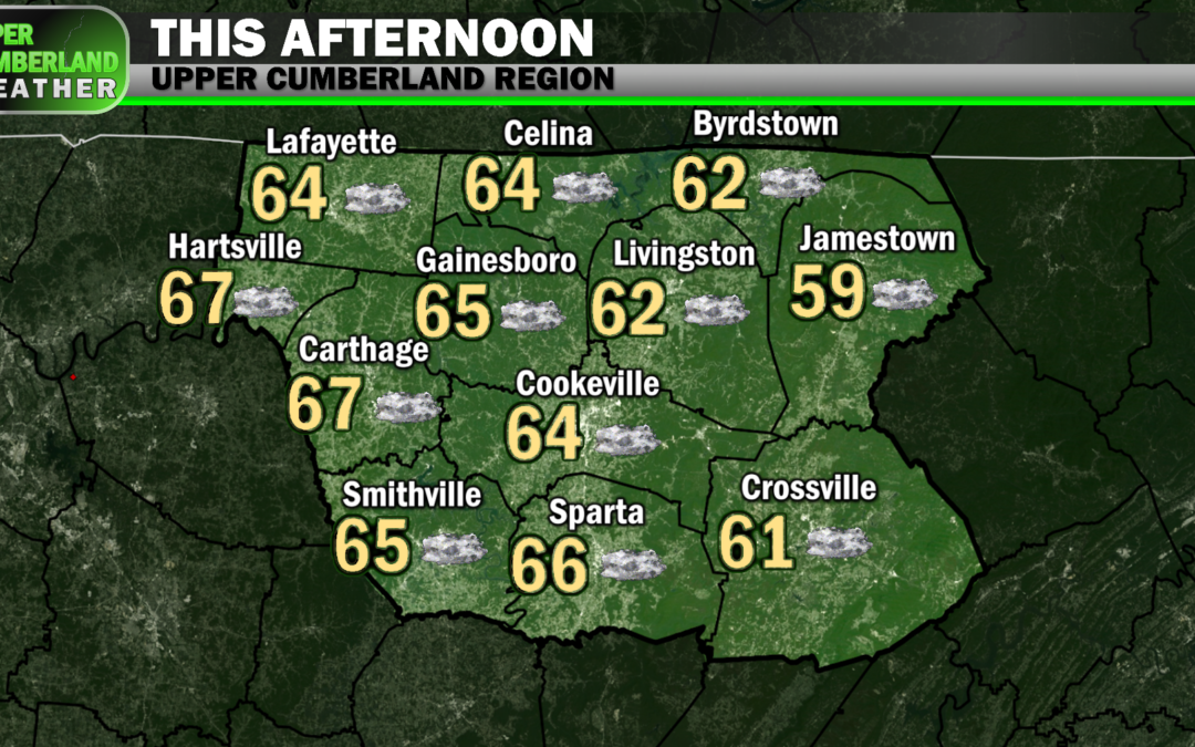
Winds shifted from out of the south while we slept, allowing temperatures to make a rare climb before sunrise. This is all thanks to a warm front that lifted through the area, setting us up for a mild afternoon with temperatures reaching the middle to upper 60s in many areas, lower 60s on the Plateau.
With the frontal passage also comes an increase in cloud cover, and it’s not out of the question a few areas could see some light sprinkles or drizzle as the day progresses. Rain showers are not expected.
Winds may also pick up a bit with a steady breeze of about 10 mph expected and gusts to 20 mph possible.
Warm air advection will continue into Wednesday with temperatures climbing further to around 70°. We’ll try to get some more sunshine in here as well but at the expense of winds becoming a bit stronger.
Winds tomorrow will continue to be out of the south at around 10-20 mph with gusts to 30 mph possible. It might be best to keep the Christmas inflatables deflated until winds die down Thursday. Santa isn’t supposed to fly through the air until Christmas Eve — don’t want to confuse the kids!
As is the case pretty much anytime temperatures climb above 70° this time of year, colder air looms somewhere in the forecast, and this week is no exception.
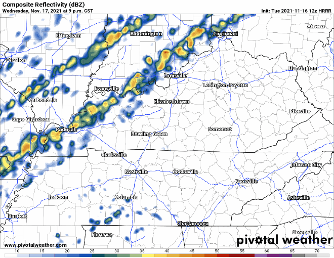
A cold front will bring mainly light rain showers to the area during the morning hours of our Thursday. We won’t see much rainfall from this event with only a tenth to a quarter of an inch expected, but do expect to have to run the wipers during your morning commute and possibly on the way home, as well.
Fortunately, this will be yet another frontal passage that doesn’t bring any severe weather worries, which I’ll gladly take!
Precipitation will clear out late Thursday with temperatures beginning a backwards slide. We’ll be down in the upper 20s waking up Friday morning (moisture will likely move out too quickly for any sort of brief changeover to wintry precipitation to occur).
We’ll end the work week dry and cold with highs Friday only managing the upper 40s in most spots.
Temperatures will warm back up this weekend, but our next weather system arriving Sunday will bring chances for light rain back into the area through Monday.