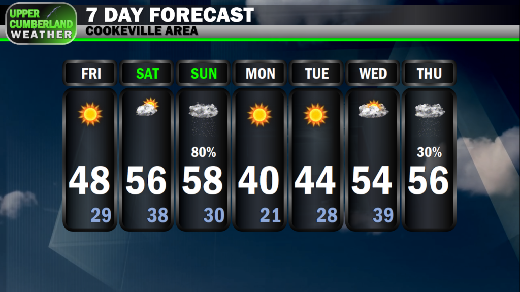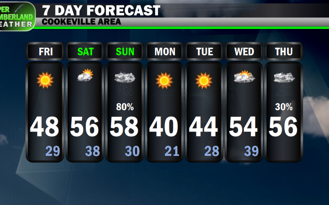
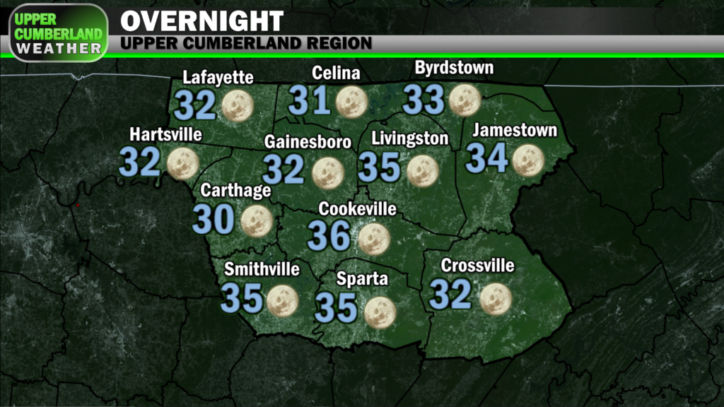
Sunshine returned today in full force, but it’s been paired with cold temperatures held down to the upper 40s in most spots. Frigid temperatures will be in store once again overnight with lows dipping down into the upper 20s to around 30 area-wide.
Despite the cold start, temperatures will rebound nicely Saturday afternoon with highs approaching the middle to upper 50s. No rain is expected, but we will see an uptick in cloud cover ahead of our next rain-maker.
A cold front will bring widespread showers to our region Sunday. Right now, it looks like this activity may not arrive until the afternoon hours, so we may be able to squeeze in church services without needing an umbrella.
Scattered showers will be with us throughout the afternoon Sunday, tapering off during the evening hours. We won’t immediately begin to feel the impacts of the cold front with highs again in the upper 50s and lows overnight Sunday only bottoming out around 30.
Monday will deliver quite the shock to the system as the effects of the cold front are finally felt. Highs across the higher elevations of the Plateau may not make it out of the upper 30s, and that’s with sunny skies! Most of us look to cross the 40 degree mark, but just barely.
Our coldest temperatures of the season thus far will be felt Monday night with lows falling all the way down into the upper teens on the Plateau, around 20 elsewhere.
Tuesday will be yet another cold and dry day, but things will change quickly heading into Wednesday as our next weather system approaches. Highs will return to seasonable norms in the 50s for both Wednesday and Thanksgiving.
Unfortunately for those with outdoor plans, it’s looking like we may see showers around Thanksgiving Day. We’ll have more details on our rain chances in the coming days as models get a better picture of this event.