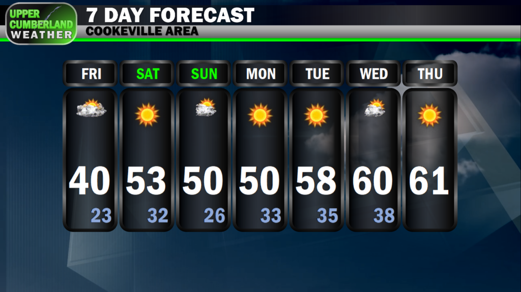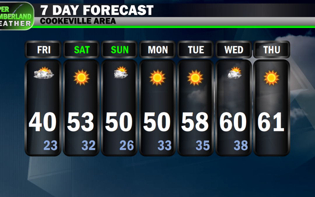
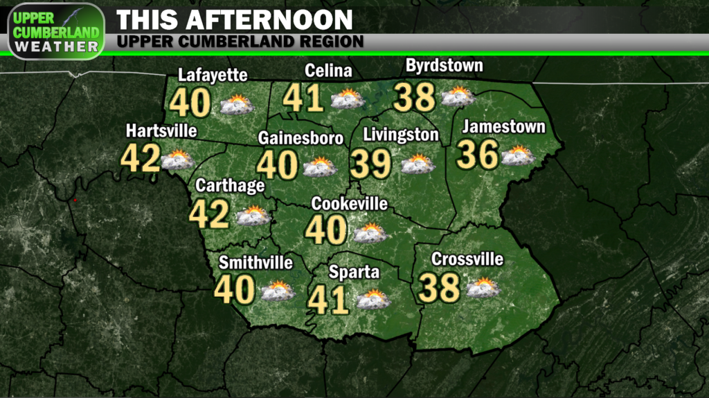
A cold front moved through the area last night, putting an end to our Thanksgiving showers and ushering in colder temperatures. We’re bottoming out around 30° and won’t climb much this afternoon. Highs today only look to top out in the upper 30s to around 40°, and that’s with clearing skies.
We’ll warm up a tad over the weekend with highs both Saturday and Sunday spanning the upper 40s to lower 50s area-wide (colder on the Plateau, ‘warmer’ elsewhere).

High pressure will take firm control of the area next week, completely eliminating any rain from the forecast and allowing above–average temperatures to take hold with upper 50s to lower or even middle 60s being possible up through at least next Thursday.
Early model tendencies show rain returning to end next week, and there are at least some indications that this could end as a bit of wintry precipitation into next weekend. We’ll have to wait and see how that pans out as we head into our first week of December…