I hope you’ve been able to get out and enjoy today’s mild temperatures, because it won’t last. It’s January, after all.
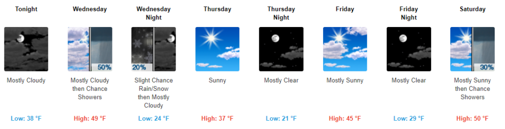
A weak, mostly uneventful cold front will swing through tonight. The only perceivable phenomena will be a drop in temperatures — with most areas falling into the upper 30s by early Wednesday morning.

Our next storm system arrives tomorrow as an upper trough brings moisture into the region. This will likely begin as just a few scattered showers during the afternoon hours as high temperatures look to reach the upper 40s to around 50° in most spots.
Falling temperatures during the evening may yield a changeover from rain to a wintry mix — and eventually light snow in some areas, especially along the Plateau.
The HRRR model below gives us an idea for how this may play out:
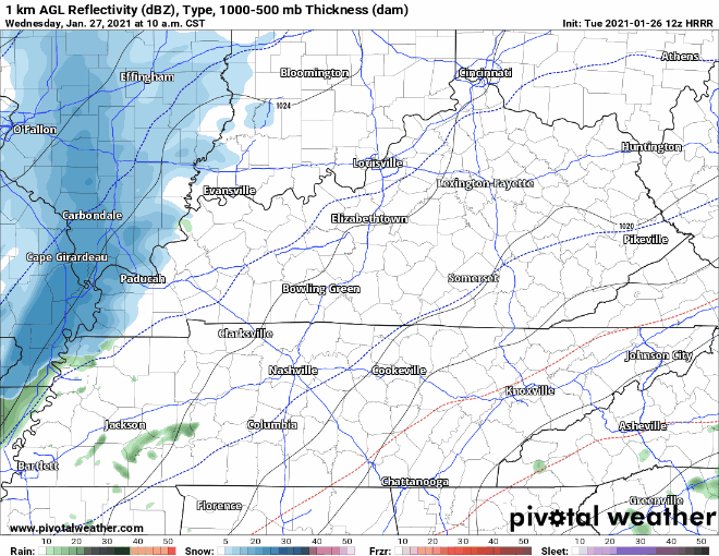
This isn’t anticipated to be a truly impactful winter weather event. Those in the higher elevations of the Plateau might eek out light accumulation amounts (we’re talking a dusting to a half inch…maybe), but the rest of us probably won’t see much, if anything.
The NWS Blend of Models isn’t very favorable for accumulation:
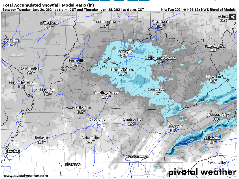
Just for fun, I’ll mention that only one of the major forecast models we look at (the GFS) wants to paint this as a multi-inch-accumulating event, but we won’t go much further into detail. If you see those wild GFS maps posted by random Facebook groups and so forth calling for a big-time snowfall, ignore them. It’s very, very unlikely any such scenario will pan out. We’ll a) be too warm tomorrow b) see too little moisture and c) the moisture won’t be in place long enough once temperatures fall below freezing. Hence: trace accumulation amounts possible on the Plateau and likely nada elsewhere.
Not holding my breath for anything to change with that, but we shall see.
Beyond Wednesday, temperatures will remain on the cool-to-cold side on into this weekend.
Our next rain system arrives late Saturday and into Sunday. As NWS Nashville put it this morning, temperatures will be too warm for snow but too cool for thunderstorms. So a plain ole, cold rain it is.